Our Latest Service
Combining our knowledge and equipment of construction set outs and locating, we now offer the ability to accurately map out and produce a high quality plan/or computer file.
It is particularly helpful for a number of situations:
It is particularly helpful for a number of situations:
- Delayed starts to digging and/or construction
- There's another big project down the line, whether it be in another couple of months, or even years
- Maybe you're moving house, and would like a copy for the next generation of homeowners
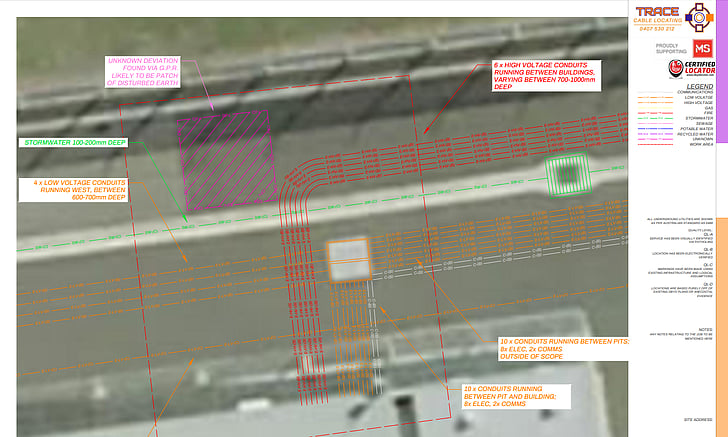
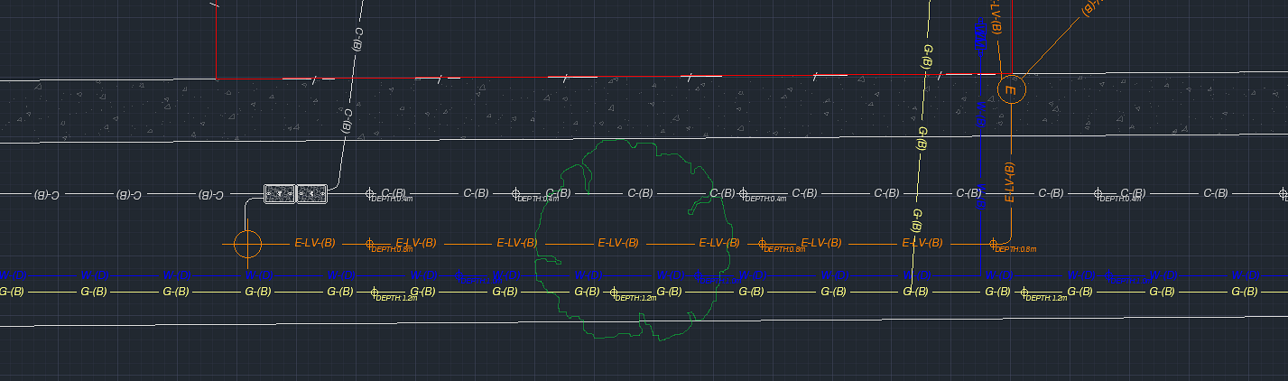
Using multiple types of equipment across different disciplines, we can ensure you get accurate, reliable plans.
Depending on the size of the job, one or two of our technicians might show up on site. To begin, the services will start being located using either electronic locating, GPR's or both. If the job is large, the second technician will begin setting up the robotic total station, and mapping points around the property, as well as marks made for the located services.
Once all the service have been recorded, the file is then put through AutoCAD to be neatened up into an easy-to-read PDF. If you are more industry experienced and require a .dwg or .dxf file, we can sort that out too.
Please note that currently we do not provide elevation data at this time, however it is a goal we are working towards.

